Five separate Schoolhouses in Holland ?
Little villages like Holland once had a schoolhouse every mile or two. Holland had no less than five schools back in 1894. The schoolhouses only had one room and were built by the people of the particular neighborhood whose children would attend class there. Students of all ages were taught by one teacher. No wonder teachers needed a gadget called an “attention gatherer,” an instrument mostly made of wood that made a loud noise if activated by the teacher‘s hand. If that didn‘t help teachers would resource to the ruler... All siblings from a family would walk together to school and watch out for each other.Most of these unadorned simple structures were built out of wood, some of brick or stone. It was the shortage of teachers during the Second World War and an increasing trend towards modernization and centralization that ended the area of the one-room schoolhouses throughout the U.S. Children thereafter would be bused to the same building centrally located to attend school. Over time, most of the one-room schoolhouses were converted into storage sheds, garages, or even small homes.
Old Sturbridge Village offers in its exhibition an original one-room schoolhouse. Another one of the surviving one-room schoolhouses is located in Sandwich, NH. Used as a private summer home for many years, the Sandwich Historical Society purchased the building in March of 1990 to preserve it as a schoolhouse. Click here to see the web-page of the Historical Society with pictures of the Schoolhouse that was built in 1825 after the original schoolhouse built in 1806 burned to the ground. The new school was named “John Quincy Adams School.” Click here, to see and read more about the Sandwich Country School.
 I always had an interest in history and started collecting postcards, photographs and maps about Holland many years ago.
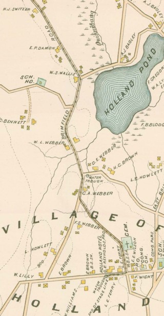
As time permits, I will share these ephemera with the readers of the Holland Blog. Today, I start with a Victorian map of Holland and Wales printed in 1894 by L. J. Richards & Co. Springfield, MA. You can click on the picture on the left to view the entire map, (file size 1.53MB).
Find the five Holland Schoolhouses on the map. They were located on today‘s Wales Road (no name on the map); East Brimfield Road; the Townhall which was also used as a school (located in the same spot as today‘s Townhall); today‘s Stafford Road (no name on the map); and on Mashapaug Road, today‘s Old County Road. That‘s right; Mashapaug Road was Old County Road according to this antique map.
The map shows several water troughs spread throughout the village to water horses and other livestock. There were also two saw mills and two cemeteries in the village of Holland according to this map.
Hamilton Reservoir did not extend into Connecticut back then and interestingly not one house was built right next to the lake. Most residents were farmers and had little time for recreation.
Another nice feature of this antique map are the names of the occupants or owners written right next to each farm or house.
Back then, Holland had public transportation in form of a horse drawn stagecoach to and from the Holland Hotel to Brimfield and beyond. The stagecoach route is marked on the map with black x‘s.

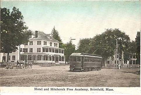
On May 6, 1907, an Electric Passenger Car Service was introduced. From then on people could travel on rails from Brimfield to Springfield or Worcester.
 The map shows a telephone office on Main Street in Wales were connections between subscribers to the service had to be established by hand.
If you would like to see more local images about past times, the Hitchcock Academy website has many published for your enjoyment, there is a link in the Main Menu of this website under “Local Links,” or click here!
If you would like to have a hard-copy of the map shown here, the file can be printed in its original format (22” by 32”) at any Fedex-Office or Staples store that has a suitable printer. You need to download the file onto a USB flash-drive or other storage-media and bring it with you to the store as they will not download it from the net themselves. Depending on your computer and the plug-ins you use, click at the following links to view or download the map: JPG-file (1.52MB); PDF-file (18.5MB).
If you have a dial-up connection, the only feasible option is the JPG file, as the other files would take to long to download. If you have a problem to download the map, call me at, 413 245 4660.
Peter Frei